
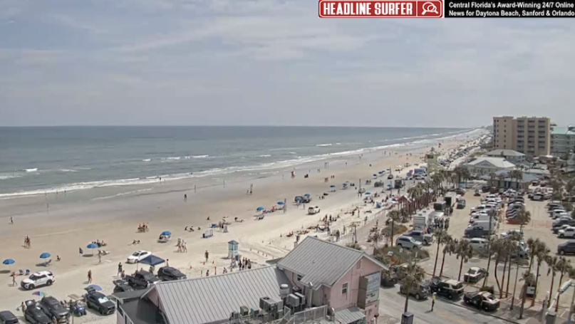
 Photo for Headline Surfer / Plenty of beachgoers off the Flagler Avenue beach ramp at 11:54 am Friday, March 14, 2025, in New Smyrna Beach, Florida. An infographic from NOAA calls for severe weather Sunday afternoon in the form of thunderstorms and strong wind gusts across Central Florida.
By SERA KING / Headline Surfer
ORLANDO, Fla. -- The National Weather Service forecast for today is plenty of sunshine in Orlando, Daytona Beach, and other locales in Central Florida, with a high near 83. The weather could get a little ugly Sunday, with a 60 percent chance of thunderstorms
Tonight will feature mostly clear skies, with a low around 63 and an East wind of 5 to 10 mph.
Saturday also features plenty of sunshine with a high of 88. There will be a southeast wind of 5 to 15 mph, with gusts as high as 20 mph. Saturday night calls for partly cloudy conditions with a low around 69, a southeast wind around 10 mph, with gusts as high as 20 mph.
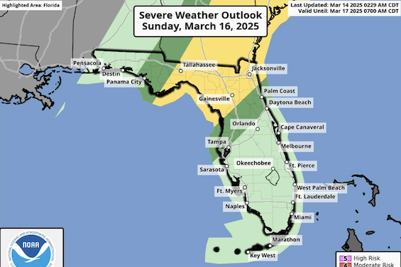
On Sunday, sunny skies with temps near 88 could give way to showers between 2-5 pm. And then things could get nasty with a 60 percent chance of thunderstorms and wind gusts as high as 25 mph, according to a severe weather warning from the National Oceanic and Atmospheric Administration (NOAA).
On Sunday, sunny skies with temps near 88 could give way to showers between 2-5 pm. And then things could get nasty with a 60 percent chance of thunderstorms and wind gusts as high as 25 mph, according to a severe weather warning from the National Oceanic and Atmospheric Administration (NOAA).
Monday could see the return of sunshine with a high of 73, but with a 30 percent chance of rain, along with a northwest wind around 10 mph, with gusts as high as 20 mph. Skies will clear Monday night, with a low around 53 and a north wind of 5 to 10 mph.
Sunny skies will return on Tuesday, with a high near 76, with a northeast wind of 5-10 mph and gusts of up to 20 mph.
Monday: A 30 percent chance of showers. Partly sunny, with a high near 69. North wind 10 to 15 mph, with gusts as high as 20 mph.
 About the Byline Writer: Sera King is a contributing byline writer with Headline Surfer, the award-winning 24/7 internet news site in Lake Mary, FL, serving Daytona Beach, Sanford, Orlando, and other I-4 / I-95 communities via HeadlineSurfer.com since 2008. King received her bachelor's degree in Business Administration from the Metro Orlando Campus of Ana G. Mendez University. Headline Surfer is owned by her husband, Henry Frederick, Central Florida's award-winning journalist: HenryFrderick.com.