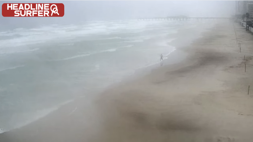
Photo for Headline Surfer / A lone person is shown walking along the water's edge along the World's Most Famous Beach in Daytona late Wednesday as Hurricane Ian began barreling across Florida.
By HENRY FREDERICK / Headline Surfer
ORLANDO, Fla. -- Hurricane Ian has been downgraded to a tropical storm as of 5 a.m., the National Weather Service in Melbourne reported.
Central Florida continues to receive massive amounts of rain. - between 6-8 inches so far.
Ian came ashore Wednesday afternoon near Cayo Costa, Florida, with winds of 150 mph and began a punishing march northeastward across the state.
As of the 5 a.m. advisory, Ian was moving north-northeast at 8 mph with winds slowing to 65 mph. It was located 40 miles southeast of Orlando and 35 miles southwest of Cape Canaveral.
"A turn toward the north-northeast is expected later today, followed by a turn toward the north and north-northwest with an increase in forward speed Friday and Friday night," the National Hurricane Center bulletin read. "On the forecast track, the center of Ian is expected to move off the east-central coast of Florida later today and then approach the coast of South Carolina on Friday. The center will move farther inland across the Carolinas Friday night and Saturday."
Ian is forceasted to produce the following rainfall amounts today:
- Central and Northeast Florida: 12 to 20 inches, with isolated totals up to 30 inches;
- Coastal Georgia and Low Country of South Carolina: 4 to 8 inches, with isolated totals up to 12 inches;
- Upstate and central South Carolina, North Carolina, and southern Virginia: 3 to 6 inches with isolated totals of 8 inches across western North Carolina.
The National Weather Service has issued a flash flood warning for Orange, Brevard, and Volusia counties until 6 a.m. and Osceola until 6:30 a.m.
Seminole County is under a flash flood warning until 6:45 a.m.
A flood warning was issued in Lake and Volusia counties until 11 a.m.
 About the Byline Writer: Henry Frederick is a member of the working press and publisher of Headline Surfer, the award-winning 24/7 internet news outlet launched in 2008 along the I-4 tourism corridor in greater Daytona Beach to Orlando from Lake Mary, Florida via HeadlineSurfer.com. Frederick has amassed 115 award-winning bylines in print & online. He earned his Master of Arts in New Media Journalism from Full Sail University in 2019. He was a breaking news reporter (metro cops & courts beat) for the Daytona Beach News-Journal for nearly a decade. And Before that worked the same beat for The Journal-News/Gannett Suburban Newspapers in Rockland/Westchester counties, NY, dating back to 1989. Having witnessed the execution of serial killer Aileen Wuornos in Florida's death chamber and covering other high-profile cases such as the George Zimmerman murder trial, Frederick has appeared on national crime shows on Discovery ID, Reelz, and the Oxygen Network series "Snapped" for his analysis.